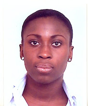
About Me

- Esther
- I am a business reporter with Daily Guide and Business Guide newspapers published by the Western Group of Companies. I was a general reporter when I joined Daily Guide in 2006, but along the line I realized the need to specialize. So I found business reporting as the best area to specialize and I have been on the desk for about four years now. Since I started reporting on business related issues my interest has being in the areas of telecommunications, the extractive industry (ie. oil, gas and mining), and the Small and Medium scale Enterprise (SME) sector. I have a page dedicated to SMEs in the weekly Business Guide newspaper were I write features on the SME sector in Ghana. In view of this I was adjudged the best SME reporter for 2009 during the Ghana Journalist Association (GJA) awards in 2010. This has further motivated me to pursue development driven stories which will help change policies and enhance the livelihoods of Ghanaians. I am a member of the Ghana Journalists Association and an executive member of the Network of Communication Reporters (NCR) in Ghana.
Wednesday, October 17, 2012
Geospatial Incompetence Robs Ghana
Aida Opoku-Mensah
By Esther Awuah
Ghana risks losing its natural resources if policy makers and indigenes do not make conscious efforts to utilize geospatial technology to monitor its resources.
According to Aida Opoku-Mensah, Director of the United Nations Economic Commission Africa (UNECA), the technology, which was being underutilized by African countries, could impact the use of natural resources.
She indicated that “one of the reasons why we have not been able to harness geospatial technology is because our policy makers do not typically understand the strategic role it plays in the development context.”
She noted that “the fact that we know there is oil in the Jubilee Fields, and that we have mineral resources means geospatial technology was being used. But the critical question is whether we are in control of how this technology is used to monitor and survey where our natural resources are.”
She said some African countries do not know how much oil is being produced per day from their shores because there is no due diligence and application of geospatial technology by the indigenes of that country.
Geospatial technology or geomatics is the technology for visualizing, gathering, storing, processing and delivering geographic or spatial information.
Ms Opoku-Mensah emphasized that “it is high time we got politicians, legislators and planners to have a holistic approach to the use of technology to countries’ advantage.”
She stated this during a day’s workshop on Geospatial Science and Technology in Accra for about 30 journalists in Accra.
The event, which was organized by the Africa Media Forum for Geo-information Systems (AMFGIS) in collaboration with UNECA and the International Institute of ICT Journalism (Penplusbytes), was under the theme, “Harnessing Geospatial Science and Technology for Socio-economic Development – The Role of Ghanaian Media.”
The workshop was aimed at educating journalists on the use of Geospatial Information in the newsroom by focusing on topics such as Introduction to Concepts of Geospatial Technologies, Case Studies of Geospatial Information Systems (GIS), Applications in Ghana with special emphasis on how to generate compelling stories.
Kwami Ahiabenu, II Co-Chair of AMFGIS stated that “Geospatial science and technology have a lot of opportunities to stimulate Ghana’s socio-economic development and journalists have an important role to ensure increased awareness of these opportunities and the workshop is coming at a right time in this direction.”
Subscribe to:
Post Comments (Atom)

No comments:
Post a Comment